MAPS OF SAANICH INLET

Ocean Networks Canada Sampling Stations

Saanich Inlet is one of the best-studied marine basins in the world. The combination of easy access and unusual features has attracted researchers since the 1930s. The most interesting feature of Saanich Inlet is the combination of dense plankton populations and deep water that is naturally depleted in oxygen. Once a year, in the late summer and early fall, oxygen is restored. The result is a fascinating study area for biologists, chemists, and sedimentologists.

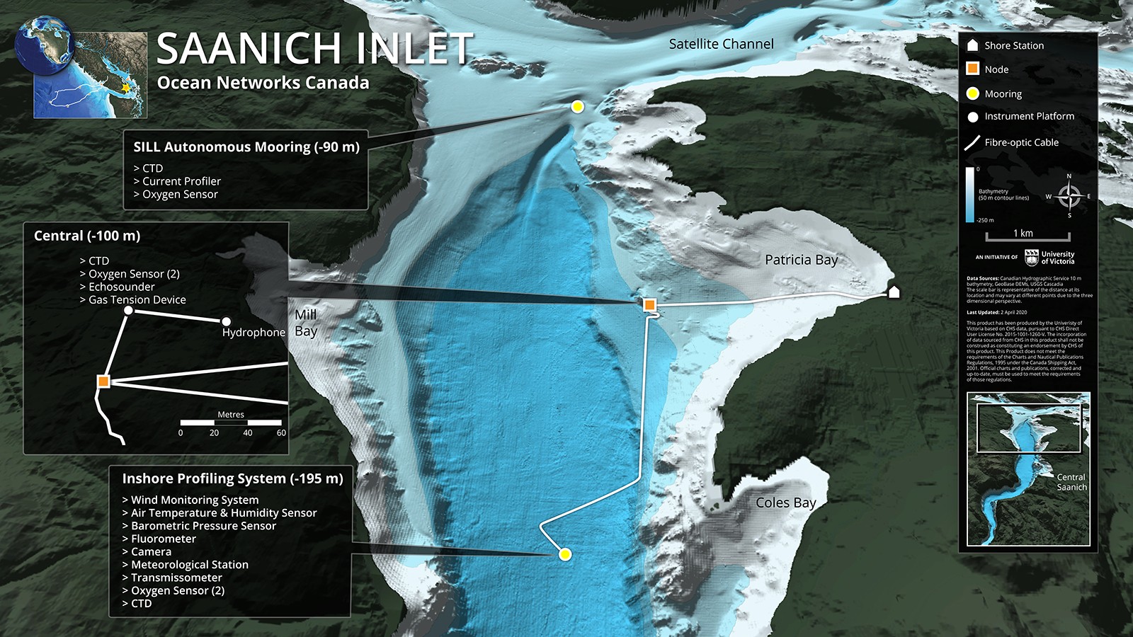
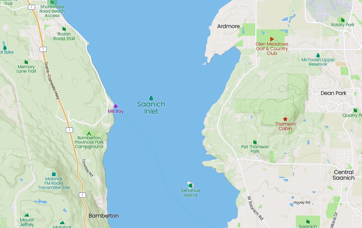
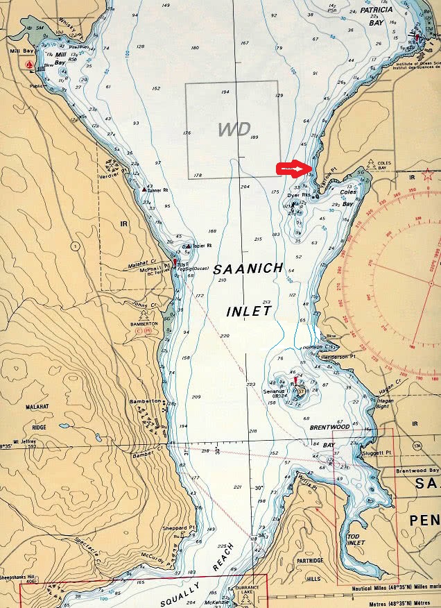
Map Of Saanich Inlet

Saanich Inlet is a body of salt water that lies between the Saanich Peninsula and the Malahat highlands of Vancouver Island, British Columbia, Canada. Located just northwest of Victoria, the inlet is 25 km (16 mi) long, has a surface area of 67 km2 (26 sq mi), and its maximum depth is 226 m (741 ft). It extends from Satellite Channel in the north (separating Salt Spring Island from the Saanich Peninsula) to Squally Reach and Finlayson Arm in the south. 
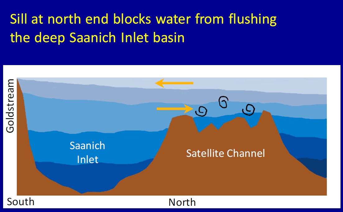
The only major tributary feeding the inlet is the Goldstream River.

The inlet has been of importance as a fishery to the Malahat and Saanich First Nations for centuries, and many Indian reserves are situated on the shoreline. Since the arrival of Europeans, the inlet has also provided a recreational and commercial fishery. It has also been popular with SCUBA divers. For several years, a port existed on the western shore at Bamberton, servicing a cement works. For most of the year the deep waters are anoxic, and hydrogen sulphide (H2S) is often detected near the bottom. In the late summer and early fall, oxygenated waters from the Haro Strait and the Satellite Channel spill over into the deep basin of Saanich Inlet.

How the North End Sill Blocks Flow

Saanich Inlet is a seasonally anoxic fjord on the coast of Vancouver Island. It is an inverse estuary where a glacial sill at the mouth restricts exchange between deep basin and external waters for most of the year. Freshwater is supplied at the inlet mouth predominantly by the Cowichan and Fraser Rivers, producing horizontal density differences that result in an inward flow into the inlet in the surface layer and outward flow at depth. During spring and summer months, high levels of primary productivity in surface waters and limited vertical mixing of basin waters below the sill result in anoxia and the accumulation of CH4, NH4+ and H2S. In late summer and fall, neap tidal flows produce an influx of denser water from the Northeastern subarctic Pacific (NESAP) Ocean that cascade over the sill, resulting in vertical mixing and the re-supplying of deep basin waters with O2 and nutrients.

Saanich Inlet Depth Chart

A glacially carved fjord, Saanich Inlet runs as deep a 234 m in its deepest place. The inlet is separated from the main waters of the Salish Sea by a shallow (75 m) sill that restricts water inflow. Currents in Saanch Inlet are usually low, although wind squalls are common in winter. Tidally-driven mixing occurs across the fjord mouth during times of spring tides. There is little freshwater input directly into Saanich Inlet; most comes from the Cowichan River to the northwest of the Inlet, driving a reverse estuarine circulation.